We are just passing through
When you consider High Woods through the lens of man’s history it is like so many other places in England: scratch the surface here and there is evidence from all the ‘great’ ages of England’s history.
We can find fingerprints from the Mesolithic, Iron Age, Roman and Norman times, Medieval, Civil War, the development of agriculture and the industrial revolution. And right up to the present day, the “Anthropocene*”, and our slide into the eschaton.
But the history of High Woods starts further back, and to truly appreciate how significant (or insignificant) man’s part in the story is we need to think about the how the landscape today was created, and how it is still evolving, and changing.
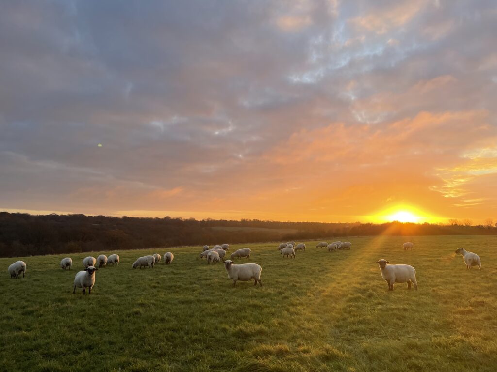
Dorset Sheep, Dec 2024, the Boat Field
It is broadly accepted by ‘people in the know’ that the earth is roughly 4.6 billion years old. That’s a big number, difficult to consider, so we need to scale that down to something approaching comprehensible. If we scale the Earth’s age of 4.6 billion years down to 46 years, then humans would have only been around for 4 hours, and in the last minute of that time, we have destroyed roughly half of the world’s flora and fauna.
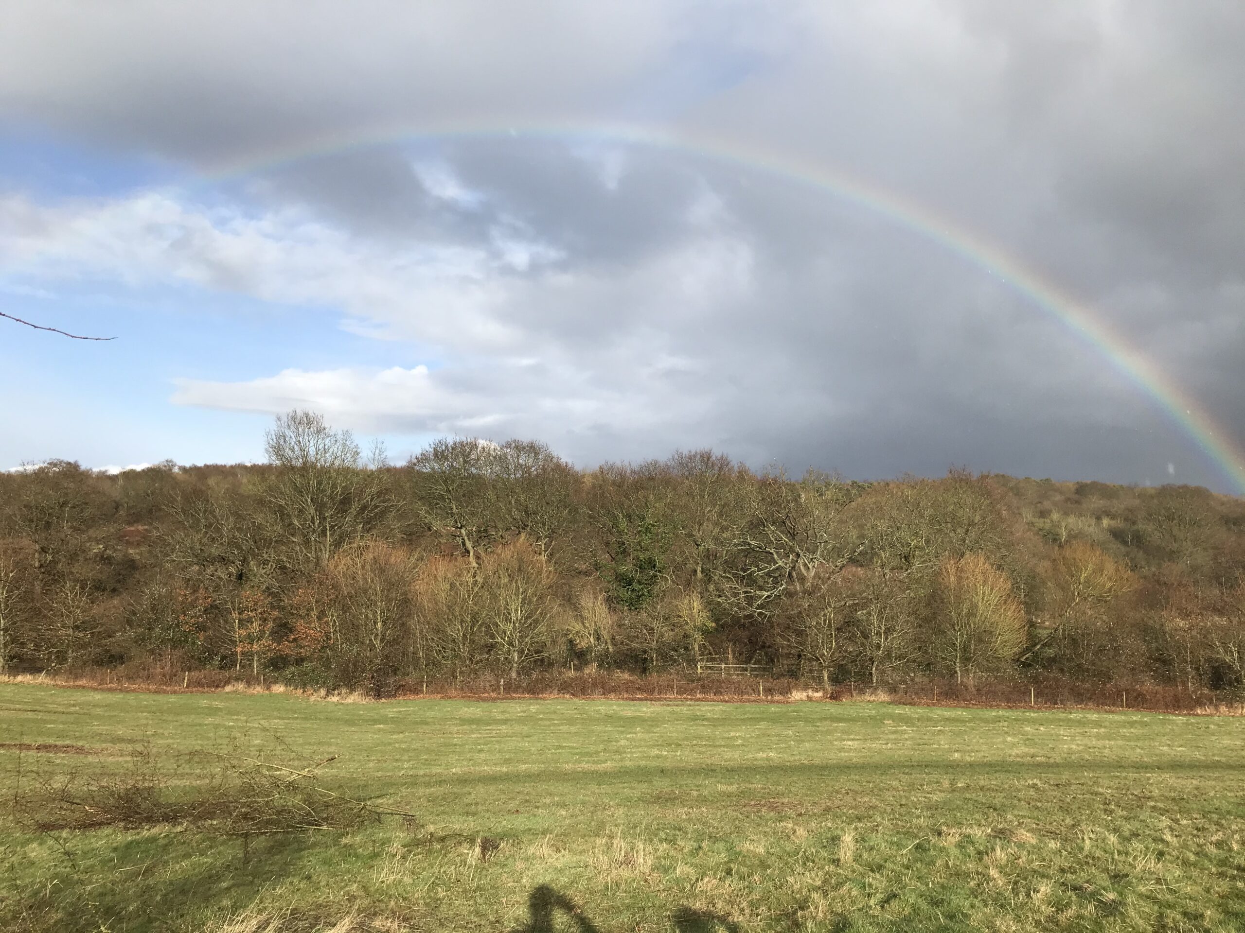
In terms of High Woods the passing of time shows a similar trend – where for the last millennium the features on the ground stayed broadly the same until very recently. High Woods and East Wood were essentially outliers, the northern boundary of Colchester, with just fields and wilderness (alias the road to Ipswich..) beyond.
Below is the Chapman & Andre map from 1777, which shows the blocks of Ancient Woodland known as (from West to East) High Woods, East Wood, Magdalen Wood and Soame Wood (better known now as Bullock Wood). These are the last remnants of the Forest of Essex which back in 1086 would have been one large block extending much further than shown here.
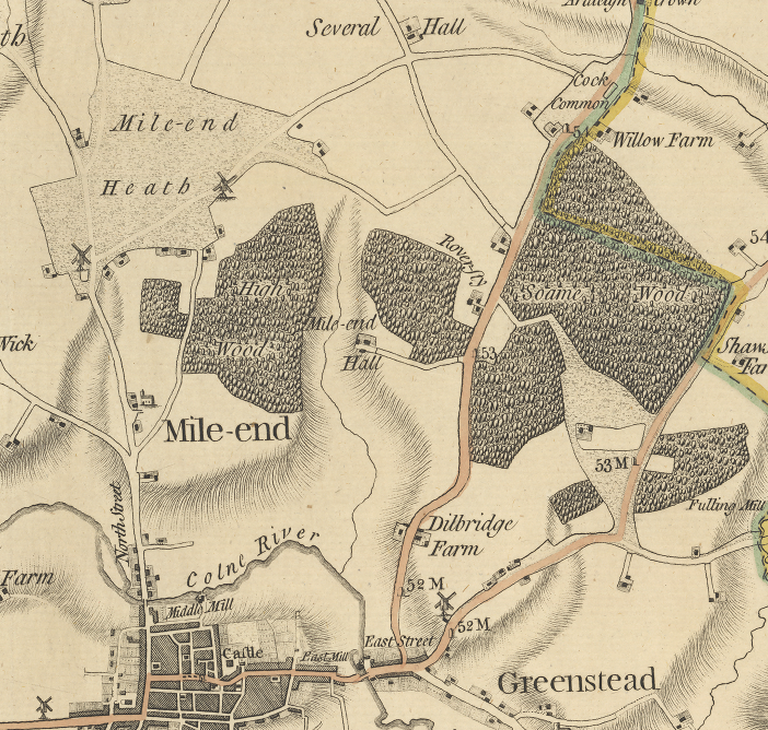
Andre & Chapman Map 1777
Compare and contrast this with the Ordnance Survey map from 1973 (pre A12) below, which broadly shows all of those blocks, just with straighter edges as agricultural efficiency and on-the-ground demarcation of ownership rights became de rigueur. There has been development, notably Severalls Hospital, and St Johns and St Anns estates but large parts of High Woods and East Wood remain.
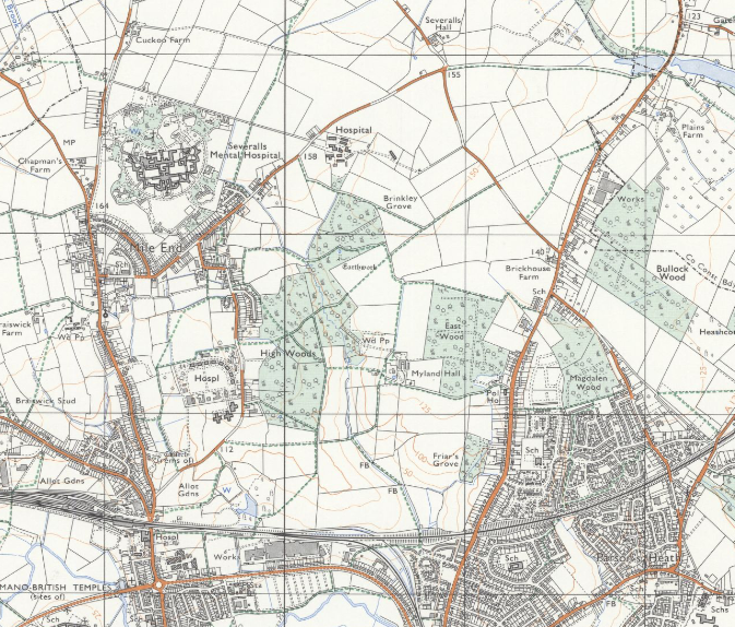
OS Map 1973
And then the current map below, which shows how, in the space of fifty years, High Woods has become effectively a green island amongst a concrete sea. Additionally, the white area on the map below, between the Stadium and the 48m spot height, is due to have houses built on it very soon, likewise the area to the east below Plains Farm has the developers circling.
OS Map 2026
Consider the boundary edges of High Woods now and they are all straight, hard stops, butting up against roads, houses or train line. There are no soft edges, or what are known as ecotones, which are are the gradual transitional zones between different habitats. Of course there are gardens, and other green interstitials but High Woods is no longer connected to the wider landscape.
Take a look back at the map of 1973 and a Badger, a Brimstone or a Blue Tit could quite easily move from Magdalen Wood To East Wood. In 2026 the chances of a Badger successfully getting from Bullock Wood to High Woods are pretty slim.
Thats one reason why, within the footprint of High Woods Country park itself, there are countless ecotone zones, with gradients tapering down from high woodland, natural regeneration, scrub, to grassland and open areas, and then back up the other side again. Almost all of these are by design. and under constant care and management by the Rangers and the volunteers.
These ecotones create a mosaic of habitats which gives the best opportunity for higher biodiversity, increased ecosystem resilience, natural buffers, evolutionary hotspots and wildlife corridors.(More detail on the importance of ecotones can/will be found under ‘The Country Park now’ heading from the menu).
I’m a realist and the reality of the South East in 2026 is that there is a voracious appetite for development. But development has to be in the right place, and whilst all development comes at the cost of the natural environment, some approaches are more sympathetic than others. Will there be more development on the current footprint of Highwoods Country Park over the next 10 years or so? Only time will tell.
Landscape
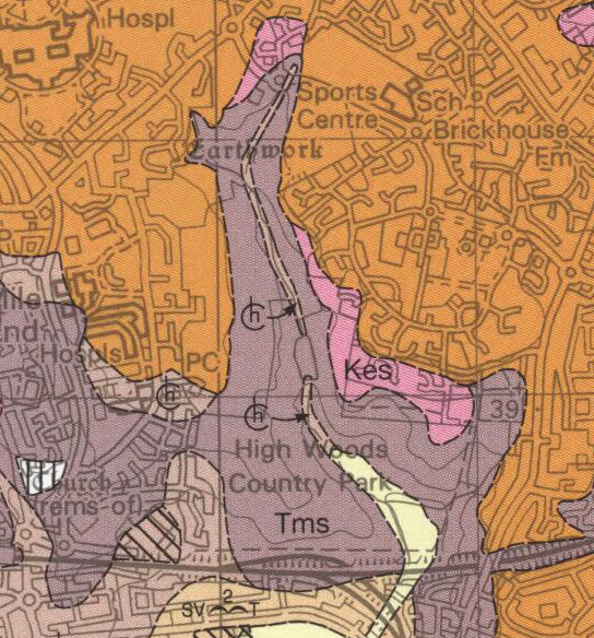
Covering an “L-shaped” area of 370 acres/150 Hectares, High Woods Country Park is situated on what is known in geological terms as the “Tendring Plateau. It rises from around 10m above sea level at its lowest point, adjacent the railway line on the southern boundary, to around 50m in Brinkley Grove (circa 1.3 miles/2.1km to the north).
Two separate streams join in the Tubswick area of the site and then flow as one through the main landscape feature which is the valley known as “the Central Valley”, which broadly bisects the site from north to south
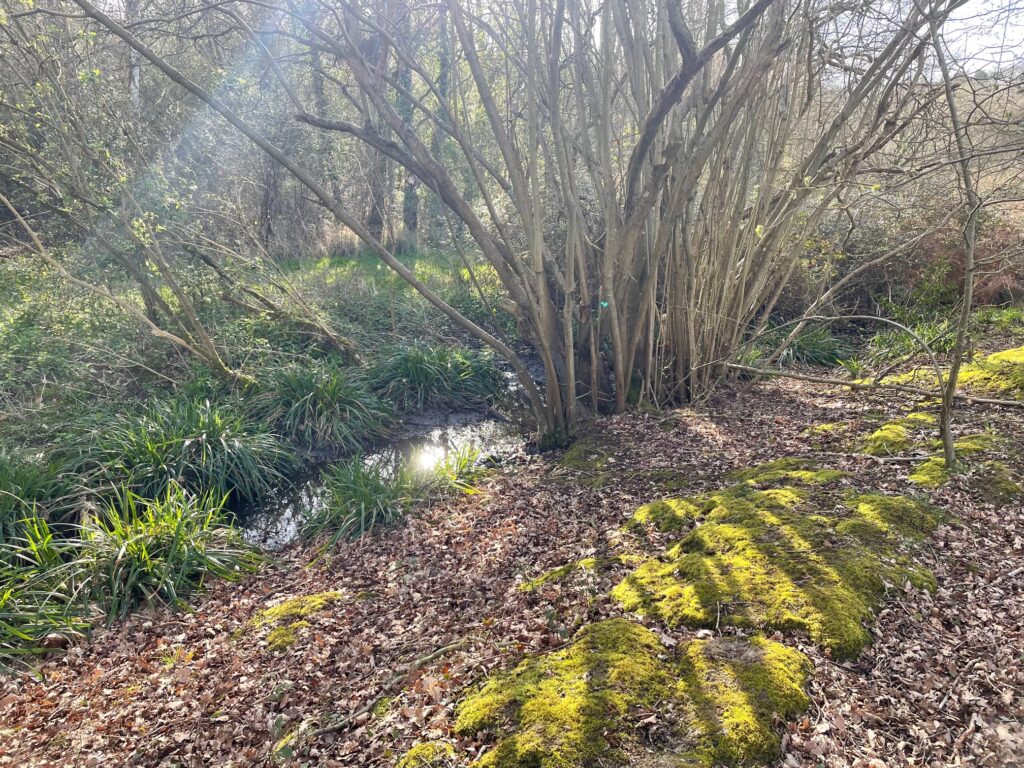
One of the Tubswick streams, March 2026
Midway it flows into an on-line lake, which acts as a storm water reservoir for the Highwoods estate. Although attenuated at the discharge point from the lake, the volume of water entering the stream at times of heavy rain can be flashy.
The stream spreads forming a marsh on the southern boundary before leaving the park through a sluice and an underground conduit, carrying it beneath the railway and Broadlands housing development to the south. It eventually enters the River Colne opposite the Lower Castle Park.
A number of additional minor springs and seasonal streams have formed small side valleys running into the main valley, for example that which issues from Friars Grove and flows into the head of the marsh on the southern boundary.
Seasonal seepage lines are a feature of the central and south-western areas. Some of the woodland soils are free draining as are those on the slopes north-east of the lake and on the rising ground east of the marsh.
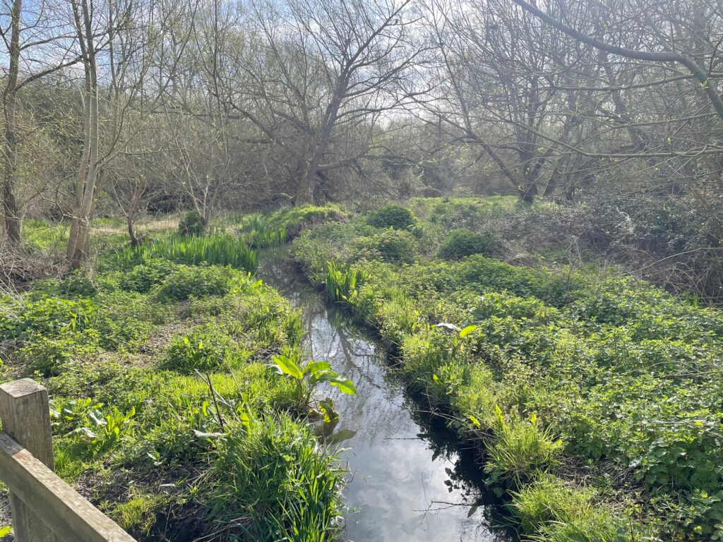
The stream as it enters the Marsh area, April 2026
The site is characterised by number of slopes and hills. The main ones, in the South, are known colloquially by Colchester Harriers AC (Group 4) as “the Hell Hills of High Woods”, such is the challenge of running up them consecutively.
For the visitor, the combination of historic paths and rolling hills provide horizon views that change with the seasons and the light. The view from the “Southern Slopes” (Colchester’s Greatest Viewpoint™) takes in the panorama of the University to the east, the Castle, Town Hall and Jumbo to Hilly Fields and Lexden in the west.
Conversely, from the town, even now, the southern slopes and the backcloth of High Woods give a view of seemingly continuous countryside to the north.
We know that in AD60 Boadicea marched on the then Roman town at the head of an army which was many tens of thousands strong. She was the warrior queen of the Iceni tribe, whose stronghold was modern day Cambridgeshire, Suffolk and Norfolk, and had joined with the Trinovantes from Essex.
We can therefore assume that she approached Colchester from the north, and easily speculate that she halted on the southern slopes and looked down on the town where she would inflict the Roman Empire’s most grievous defeat in Britain. What the inhabitants of Colchester felt, as the shadow of that host fell across them is hard to imagine.
Aerial maps help show that the site is approximately 50% under wooded canopy, mainly to the north, and 50% open, mainly to the south. But at ground level, the landscape is a rich mosaic of habitats, many delineated by arterial hedgerows, all highly valuable from a Biodiversity point of view (more detail on Hedgerows in the Habitats section).
The railway embankment on the South Eastern boundary of the site was built in the 1930s, when 7-ton locomotives were used to bring sand via a light railway from a pit on the Harwich Roads. The sand was then topped with clay to form the embankment.
Geology
Although there has not been a specific geological survey of the land within the Country Park, it is possible to construct a picture of the soils and rocks beneath, based on what can be seen, and what surveys elsewhere in the region suggest may be present.
Around 100 million years ago, in the Cretaceous period, the land that is now High Woods lay at the bottom of a warm sea of clear blue water, in which deposits of chalk were forming from the calcareous remains of minute marine organisms. At High Woods, these deposits are now several hundred meters thick (although of course entirely covered by the later London Clay). Subsequent movements of the earth’s crust pushed the chalk up to become dry land, where it suffered considerable erosion.
Around 50 million years ago, in the Eocene period, the land sank beneath the sea again and the chalk became covered in a deposit made up of fine particles of river borne sediments which eventually formed the London Clay. This is characterised in places on site as a stiff dark or bluish grey clay, which weathers to brown on exposure and shrinks and cracks in the Summer, with large fissures being very common across the site.
At the end of the period of London Clay formation, around 10 million years ago during the Miocene period, plate tectonics that were creating the Alps also pushed Essex back up above sea-level one again.
The period we call the “Ice Age”, began circa 2 million years ago, and during the greatest extent of its cover around 300,000 years ago, the icesheet penetrated well into north-east Essex, covering High Woods, and brought with it not just ice but a mixture of clays, sands and gravels.
As warm period followed cold so the melt water at the edge of the ice spread sand and gravel in the form of glacial outwash (sand, gravel, and finer sediment deposited by running meltwater streams in front of a glacier). The last glaciation took place 10,000 years ago although it did not reach as far south as Essex.
Walking within the Country Park the soil can be seen to consist of a brown, sandy clay containing some gravel and silt. This is known as Loam and is largely glacial in origin. The fragments of gravel within it, a mixture of quartz, flint and sandstone, are generally rounded, which indicates erosion by ice or water.
A core sample taken from the Country Park might therefore show two or three hundred metres of chalk covered by one hundred metres of London Clay upon which lies a deposit of glacial sand and gravel 4 to 6 metres thick. The final covering of loam may be up to 7m in thickness.


British Geological Survey Map 2010
Traditionally, outside of the woodland, the valley floor was used for pasture as the clay was generally too impervious for cultivation. Although much reduced, a strip of grassland still follows the valley bottom, whilst the extended arable fields such as Old Ley, and Boat Fields, were known for their difficulty of cultivation.
In addition, deposits of Brickearth, which are windblown alluvial soils, can be found at High Woods. As its name suggests this form of clay is ideal for brick and tile making and gave rise to the industry particularly to the north of Colchester.
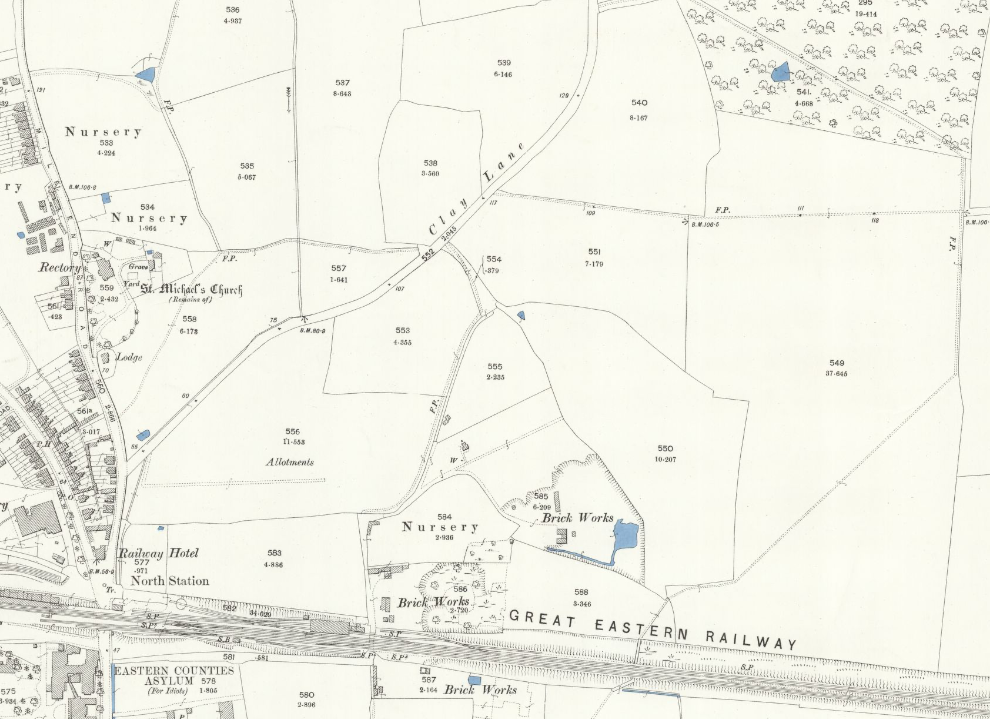
Turner Road was originally called Clay Lane, and the 1842 Tithe Map includes fields called Potters Field, Clay Pits and Kiln Field. There is also the Bricklayer’s Arms pub at the foot of Bergholt Road, and Brick Kiln Way in Great Horkesley.
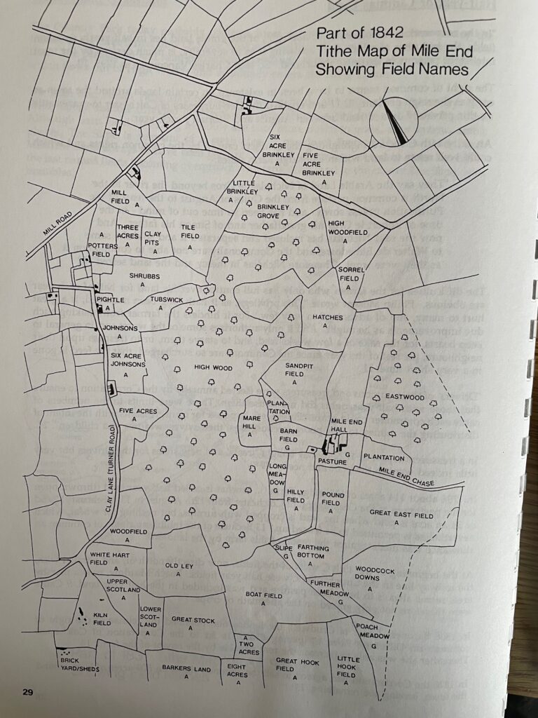
A brickyard dating back to at least 1842 was situated just at the south-west boundary of the Country Park on what is now Turner Rise (per map below) , exploiting an accessible Brickearth deposit, although this ceased production in the first half of the 20th Century. This clay can also be found in the area of the marsh adjacent the railway line on the Country Park’s southern boundary.
Many people, including this writer, can remember the large pit in this area which was used by young hooligans for the scrambling of both push bikes and trials bikes. This pit, with a pond at the bottom was very steep and had surely been the excavation site for the clay. As recently as the early 90s it was a wilderness but now lies under the Peto Avenue development, or ‘Asda View’ as it is sometimes known.
Although housing since the 1980s, “Sand-pit Field” to the north-east of the main lake in the was an area where the loam soil was thin or non-existent and sand and fine gravel exposed. This was utilised for various purposes when it was part of Myland Farm, with a pit excavated, now long filled in.
So, as regards the deposits of river and glacial borne sands and gravels, the geology within the Country Park footprint is relatively varied. And looking to man’s partnership with High Woods, it is the climate, the shape of the landscape and the nature of the soils upon it that have governed his utilisation of the land and created the environment we see today.
Puddingstone
Complicating the soils of the area even further, rivers carried sands and gravels from afar and deposited them, these in turn being moved and mixed during the glaciations.
During the Early and Middle Pleistocene, the original course of the River Thames appears to have migrated progressively south-eastwards through northern Essex, settling into the mid-Essex Depression through Chelmsford and Colchester before final diversion by the Anglian ice sheet into its modern valley through London.
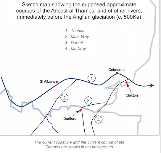
It is probable that the Thames once ran across what is now High Woods. The ice sheet that covered southern England to a depth of 1,000 metres sometime between 300,000 and 400,000 years ago, then blocked the river valley and diverted the Thames into its present course. This theory is supported by the discovery of a puddingstone at High Woods in the 1980s.
Pebbles in puddingstone were originally flint nodules, which were stripped from the Chalk by millions of years of erosion and pounded together on beaches that have long since vanished. These ancient, rounded beach pebbles were then laid down as pebble seams of the Reading Beds about 55 million years ago and later raised above sea level.
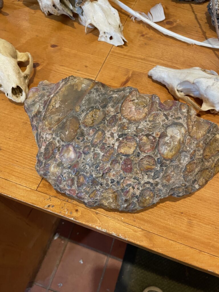
The High Woods Puddingstone
Puddingstone is usually called ‘Hertfordshire puddingstone’, as the blocks that are found in Essex most probably originated in Hertfordshire. The erosive power of the Thames, flowing far north of its present course, then carried large boulders of puddingstone into Essex
Puddingstone has been the subject of many superstitions, one of which was that it grew in the soil, hence the name ‘growing stone’. This belief has led to fine examples being destroyed out of fear that they might eventually block rivers or destroy crops. Puddingstone has had practical uses, particularly in Roman times when its great hardness made it useful for making querns for grinding corn. Stone Age man also knew of puddingstone – in Colchester Museum is a puddingstone hand axe from Braintree.
* We are now living in the Anthropocene epoch. This is characterised where humans have become the single most influential species on the planet, causing significant global warming and other irreversible changes to land, environment, water, organisms and the atmosphere.
References:
GeoEssex Factsheet No 2 Compiled by Gerald Lucy Revised 31 Dec 2009