This is where it all starts for me. Maps, Ive got a few, but then again too many to mention.
Cartographers from the 16th and 17th centuries have a reputation for using previous maps as the base for their new map so errors are commonly passed on from one map to another. Additionally, and anecdotally, they often didn’t actually visit every part of the area, relying instead upon local knowledge from friendly natives, and/or ‘artistic interpretation’. But, in every case they made a far better job of it than I would have made,
The maps that we do have reveal the etymology and toponymy of the area, as well as clearly illustrating how the mapping of the area became more accurate over time.
Importantly for High Woods, the provenance of ‘Ancient Woodland’ is now recognised to be pinned to map development; as a sweeping generalisation, maps produced pre 1500 Ad were pretty unreliable. However, maps produced after 1600 AD were becoming sufficiently accurate to roughly reflect what was actually apparent on the ground.
In terms of Woodland history, it is therefore possible to trace the existence of woodland from 1600 to the present day. When combined with other evidence, such as the existence of indicator species (Bluebells, Wood Anemone, Celandine, Yellow Archangel, all of which are found at High Woods), it is reasonable to designate those woods as Ancient Woodland.
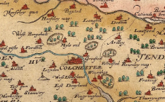
Christopher Saxton, 1576
This was the first County map of Essex ever produced. Certain estates, including High Woods, are shown as enclosed, or impaled, telling us that it was private land, belonging to somebody of significant wealth.
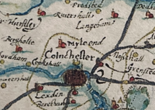
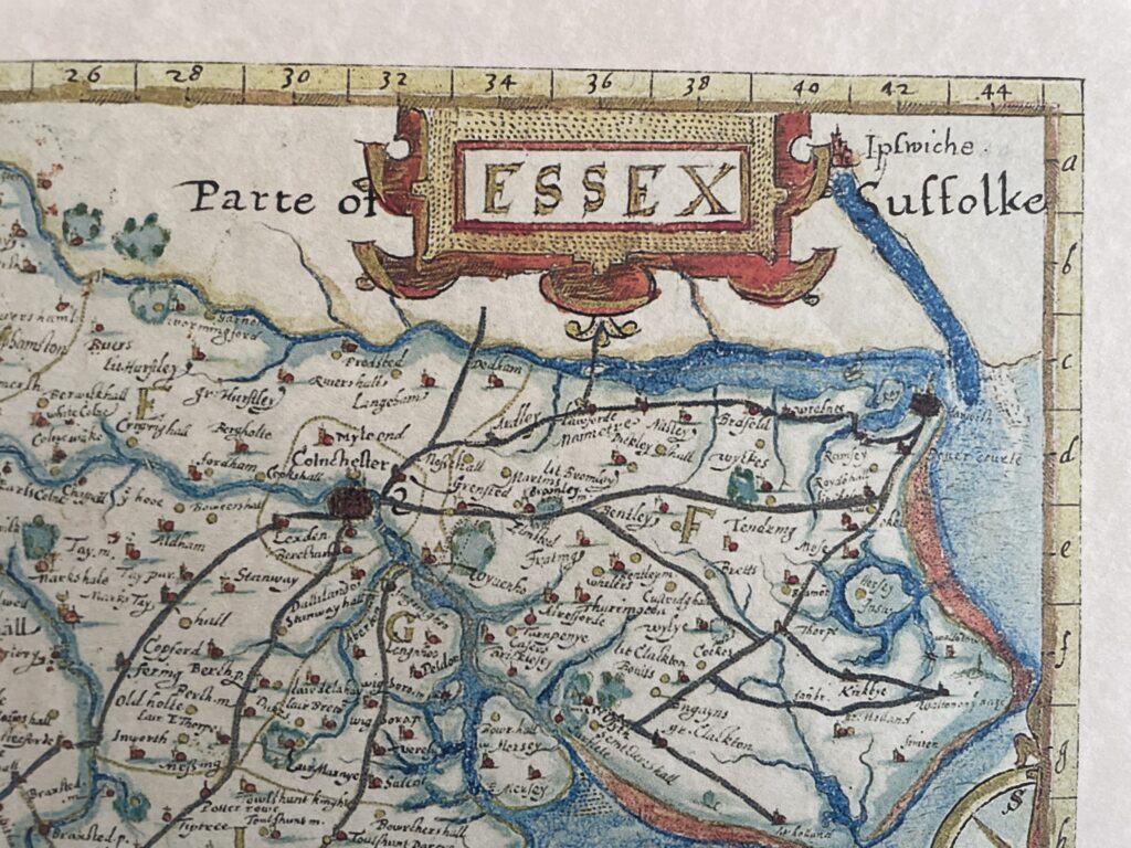
John Norden, Parte of Essex, 1594
John doesn’t easily highlight High Woods, or East Wood, on his map, but with a magnifying glass you can pick out a green blob below the ‘e’ in Colchester, north of the Colne, and that must relate to them. If we zoom out on John’s map (below) though we see he has included a ‘grid’ of numbers along the top of his map, and letters down the side. This was huge innovation in English cartography, and established the grid reference system that we still use today.
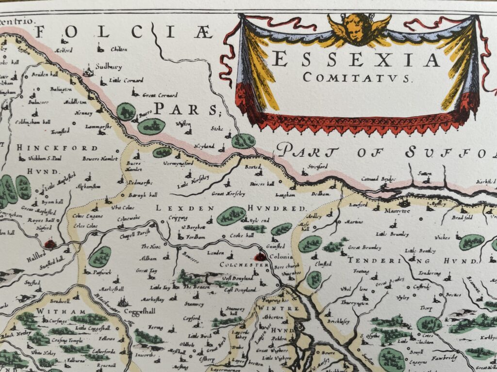
Joannes Blaeu, Essexia Comitatus, 1645
Again, the scale and accuracy of Joannes’ map does leave a little to be desired, but the green oval block between the words LEXDEN and HUNDRED is probably High Woods, and then East Wood, and Soames (Bullock) Wood.
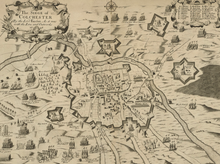
A map of the 1648 siege of Colchester
This was published in a contemporary broadsheet entitled “A diary of the siege of Colchester by the forces under the command of General Fairfax”. It concentrates on roads and fortifications, and the relative location of particular military units on the ground, rather than accurate topography.
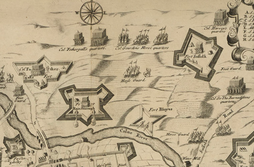
An extract from this map suggests Fort Suffolk is in the vicinity of what is now Chanterelle car park. Its remit was to control escape from the town, or reinforcements from reaching it, via the Suffolk Road (now Ipswich Road).
In ‘An Account Of The Siege And Blockade Of Colchester, A.D. 1648’, Daniel Defoe states:
22nd June 1648 .This day we had news in the town that the Suffolk forces were advanced to assist the besiegers, and that they began a fort called Fort Suffolk, on the north side of the town, to shut up the Suffolk road towards Stratford. This day the besieged sallied out at north bridge, attacked the out-guards of the Suffolk men on Mile End Heath, and drove them into their fort in the woods.
Fort Rainsborough is similarly suggested to have been to the west of the Southern Slopes. The Forts look very substantial and well built on the map, but in reality they were ‘field forts’ and would have been little more than a fortified encampment.
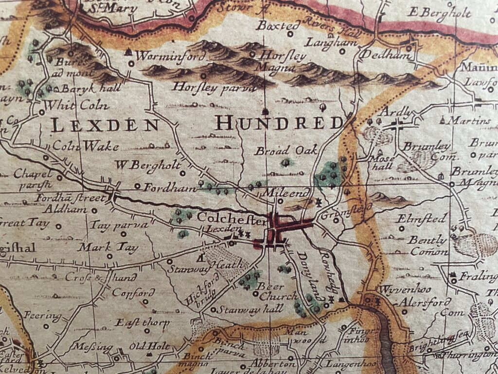
John Ogilby and William Morgan, “Essex actually surveyed with the several Roads from London”, 1678
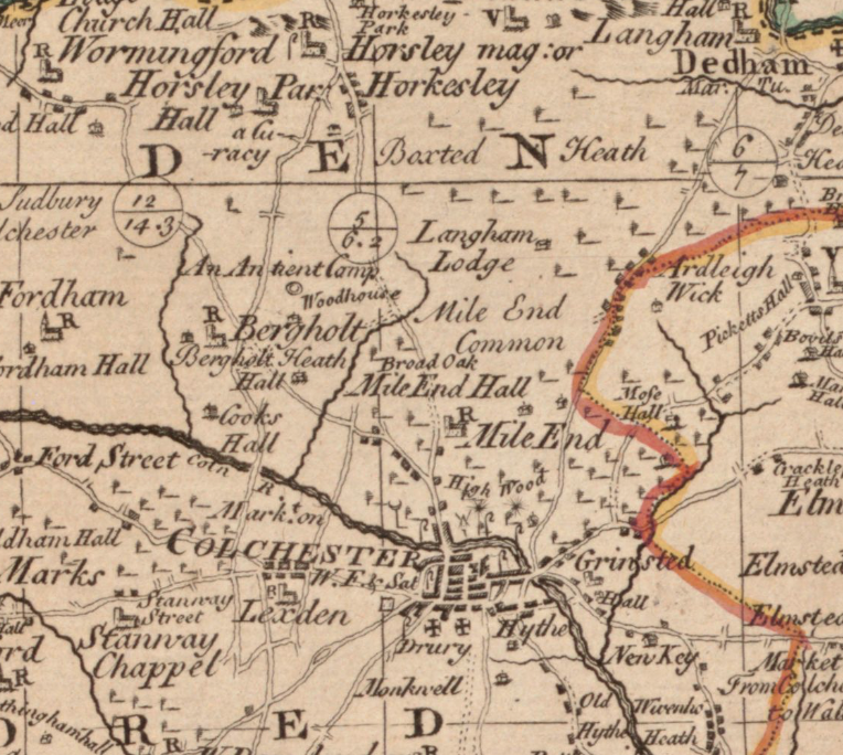
Emanuel Bowen 1764
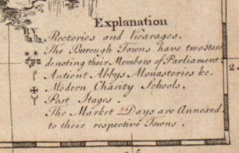
Emanuel Bowen legend – the ‘R’ in Mile End is the Rectory
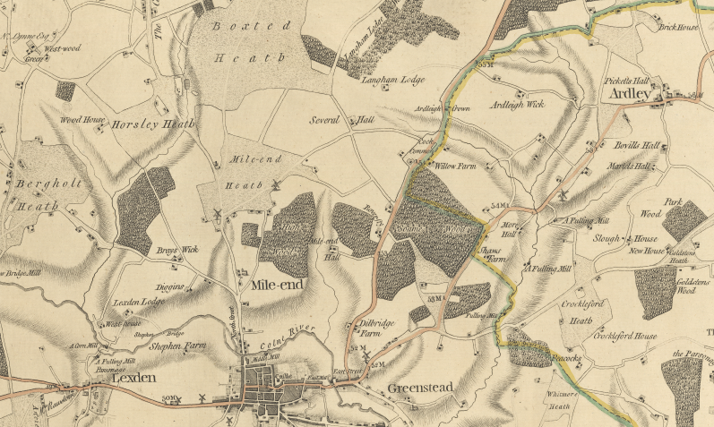
Chapman & Andre Map – 1777
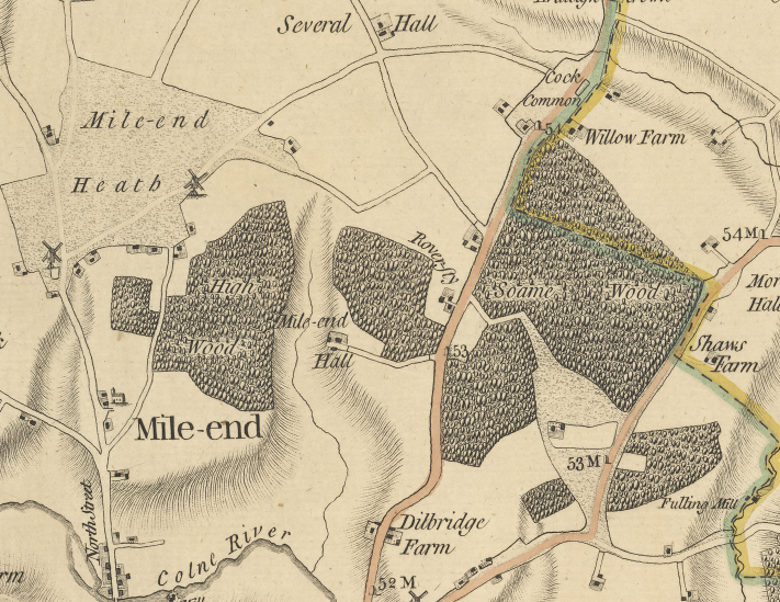
Chapman & Andre Map 1777 focused on Mile-end
The Chapman and André map of the district of 1777 shows, with reasonable accuracy the position and quantity of heath and woodland at that date. Oddly, Brinkley Grove and Friars Grove, both woods now within the Country Park are omitted. Perhaps they had been recently coppiced and appeared, if a close inspection was not made, to be no longer woodland. Chapman and André had a reputation for mapping from the roads.
The map shows two windmills on the southern edge of the heath. Mile End Mill East, situated south of Mill Road was a post mill, that is where the superstructure revolves around a central huge supporting post so that the sails are always appropriately positioned in relation to the wind. The mill, erected in the 1760’s by John Matchett was destroyed by fire in 1807 but rebuilt. In 1832 it contained two pairs of stones and flour mill. In 1881 the mill was sold for £910 and the milling record ceased shortly afterwards.
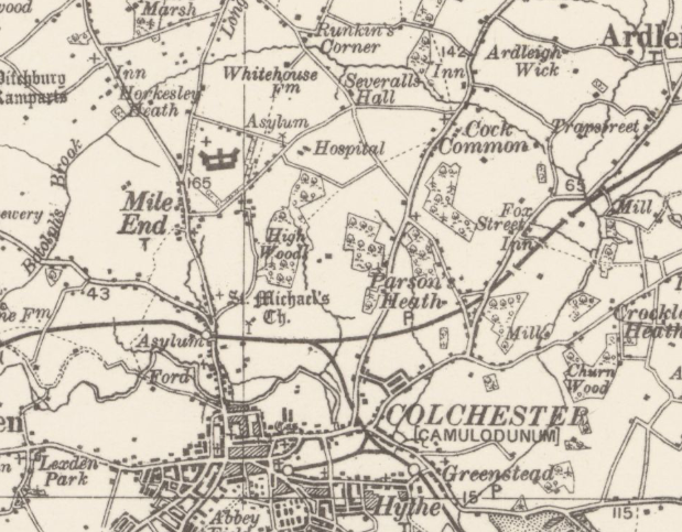
Unknown origin, 1926
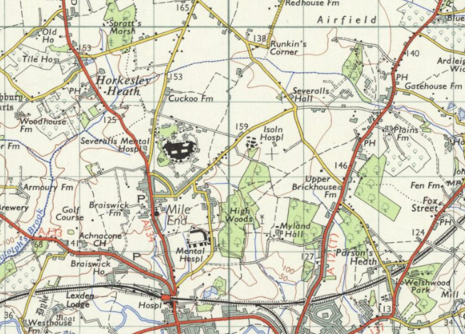
Ordnance Survey Map 1956
**this section is work in progress**