It is difficult to be certain what the Romans ever did for High Woods but knowing how they were so proactive in identifying natural resources its certain they would have understood, and exploited, the site’s value to them.
The earliest local evidence for woodland management in general, and coppicing in particular, is provided appropriately enough by the Romans, for whom Camulodunum, or Colonia Victricensis, is such a key part of their history in Britain. We know that woodland was highly prized by the Romans for many reasons, including the fact that it provided fuel for industries like mining, smelting and production of ceramics.
High Woods, as well as East Wood, was in existence during the Roman occupation of Colchester although almost certainly as part of a much larger area of woodland to the north of the town. So, it is entirely possible that as well as being used by the Romans for hunting the woodlands were exploited by them for timber and underwood and managed with this in mind.
The arboreal legacy of the Romans stretches right across Europe, and it is known that they had a particular penchant for Sweet Chestnut for its fast-regrowing timber and its ability to quickly sprout new poles. These poles were naturally very high in tannins, which makes the wood resistant and long-lasting. They did not tend to value the fruit much – in Roman culture, it was portrayed as a rustic food of poor, rural people in Roman society, such as shepherds, with the nuts often ground into a flour.
It is a bit of a cliche that the Romans introduced Sweet Chestnut to Britain but that may not be accurate; for years, it was widely accepted but recent archaeological, and archaeobotanical, research by the University of Gloucestershire suggests this may not be the case, with the Normans and other European visitors being credited.
However, the Small-Leaved Lime will definitely have been in High Woods at the time of the Romans. Its a native British species, prevalent since the last Ice Age, and one of the best indicators of Ancient Woodland. It was historically valued for producing straight poles, fuel, and also ‘bast’, a strong, fibrous material harvested from the bark for making ropes, mats, and tying materials. Its soft, light-coloured wood was also prized for woodturning, carving, and crafting household items like bowls, spoons, and agricultural tools. It is highly likely therefore that the Romans coppiced Small-Leaved Lime at high Woods.
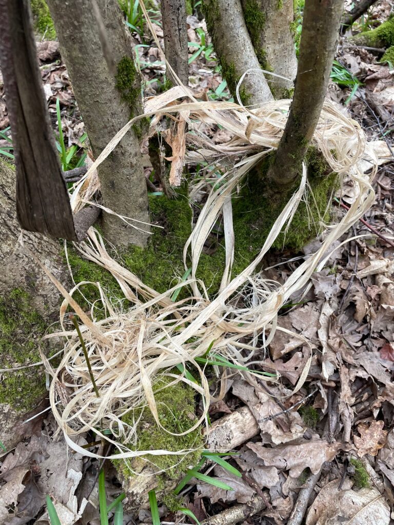
Bast’ from a naturally broken limb of a Small Leaved Lime, Central Valley March 2026
One thing we definitely do know, from Tacitus , and Cassius, is that in AD 43, the Emperor Claudius journeyed from Rome to head the invasion of Britain and lead his troops against Cunobelin’s (Shakespeare’s “Cymbeline”) British stronghold at Oppidum Camulodunum. Historians seem to agree that Claudius brought with him war elephants to Britain, so it is possible that not only Romans, but also their elephants briefly foraged across High Woods.
As yet (although see below), there is no direct evidence of elephants but archaeological excavation of Roman kilns in Colchester has shown that they were often fired with wood of small diameter, the sort of size one would expect from a regular, short term coppice cycle. It’s reasonable to assert therefore that the Romans coppiced woodland in High Woods for their kilns and fires.
Similarly, excavations of Roman buildings within the town destroyed during Boadicea’s rebellion in AD 60 have shown house walls to have been constructed of wattle and daub. The wattle was a woode framework, very similar to a sheep hurdle, onto which the clay or plaster was daubed. As with a sheep hurdle the wattle was woven from small diameter wood, again suggesting coppice management of woodland.
Roman road in High Woods?
Anyway, back to the elephants… There is evidence for two large man made earthworks in High Woods. The one in Brinkley Grove (see section below), and one that cuts across the Central Valley, which is potentially a section of Roman Road. The earthwork has always been visible on the ground but Colchester Archaeological Group used a technique called Lidar mapping to see it more clearly from above. Lidar mapping is a means of measuring the relative ground levels using lasers and which shows up man made features very well.
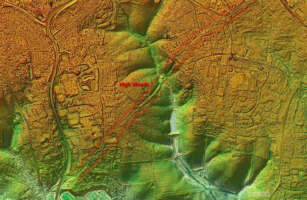
In this slide we can make out the size and direction of the earthwork in the wider landscape.
The earthwork in question runs SW/NE on the attached Lidar photos, and is almost a straight line, formed of two banks either side of a cutting. The distance between the tops of the banks is approx. 35m, and the depth of the cut is several metres, so it is something quite significant. It is possible that the feature was made to reduce the gradient down to the stream which it crosses.
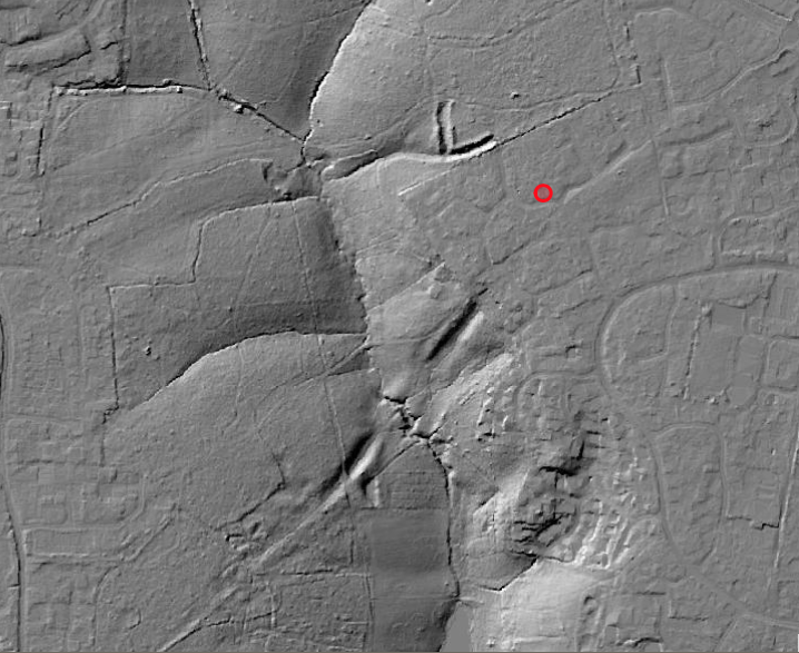
This is a more zoomed in view (the L shape above is the earthwork at Brinkley Grove)
If we project the direction of the earthworks out it appears to join Turner Road at the SW end (near to North Station)and Brinkley Lane at the NE end. And if we draw a straight line even further North East we arrive at Ipswich, although current thinking is that the Roman road to Ipswich left Colchester from the East Gate, so why would they need this road as well? Perhaps it could be part of the Civil War siege works, or the Iron Age dyke system. But then that doesn’t match with the Bluebell colony there.
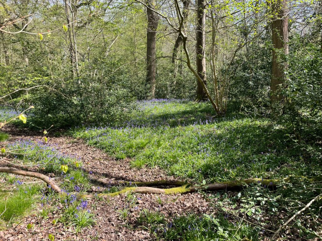
The fact that Bluebells are an indicator of Ancient Woodland soils is a relevant piece of forensic evidence. . Bluebells are known for an agonisingly slow spread rate, often measured in just centimetres per year. This slow horizontal expansion is why they are considered a primary indicator of Ancient Woodland—their presence in large “carpets” suggests the soil has remained undisturbed for centuries. There is a very significant radius of bluebells atop the earthworks which using the rough calculation suggest that the bank predates the civil war at least.
So this is one of the features that we are still waiting to fully explain itself to us.
Earthwork at Brinkley Grove
And here is another one. It is the only Scheduled Ancient Monument (SAM) on the High Woods site and is the L shaped form on the Lidar maps above. Once again, there are various theories as to its origin, spanning Iron Age, Roman, and Civil War, being probably some sort of fortification.
The https://colchesterheritage.co.uk website describes it as follows:
“Earthwork, consisting of the south west angle of an apparently rectangular, with a ditch 60ft wide and 9ft deep, with an external and an internal rampart. Defensive earthwork consisting of two banks with ditches set at right angles. Only traces are visible in the wood. Dimensions: south bank 184ft, west bank 113ft, both banks about 3ft high, south ditch 50ft wide, west ditch 58ft wide, both ditches about 8ft 6ins deep. Apparently partly destroyed within the wood, though perhaps it was never completed? Most of the northern ditch is wet south of a pond. Earthwork was in good condition in 1980. Field walking was to be arranged, field walking was to be arranged. In 1990 it was reported to the SMR that house building in High Woods had reached the outer bank, and work was also in progress clearing trees, coppicing etc within the earthwork itself. HBMC are aware of the latter.”
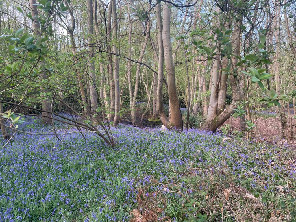
Once again, the presence of an extensive carpet of Bluebells suggests that this probably predates the Civil War. Sadly, in 2026 parts of it are heavily denuded, and the bluebells destroyed, by man-made bike jumps, and ever increasing footfall.
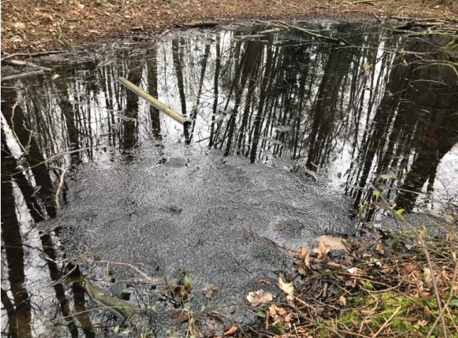
But still, for now at least, each Spring the pond within the earthworks bubbles with mating frogs which produce “..the warm thick slobber of frogspawn that grew like clotted water In the shade of the banks..” (Seamus Heaney, Death of a Naturalist).